📷 Photo by Original uploader was Daderot at en.wikipedia · CC BY-SA 3.0 · Wikimedia Commons
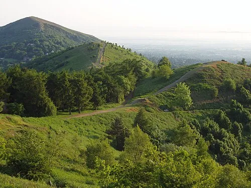
This 109-mile walking trail stretches across four counties from Bridgnorth in Shropshire down to Gloucester, making it a proper undertaking rather than something you'd knock out in a weekend.
Most walkers tackle it in sections, breaking their journey into manageable chunks between the market towns along the route—Ross-on-Wye and Forest of Dean among them.
What sets the Geopark Way apart is its geological thread. The route takes you through landscapes shaped by different rock formations spanning various geological periods, with interpretation panels dotted along the way to help you understand what you're looking at. The terrain itself is refreshingly varied: you'll pass through woodland, farmland, river valleys, and open hills, so there's always something different to engage with as you walk.
The trail's structure makes it friendly for stopping and starting. You could walk a section over a day or two, stay overnight in one of the towns, then return another season to continue further. Waymarking is generally reliable, though carrying a map or guidebook is sensible.
You'll need reasonable fitness and proper boots—the Cotswolds hills can be muddy and unforgiving otherwise. Spring and early summer are ideal, though the countryside works well most of the year. Whether you're fascinated by geology or just want a longer walk through varied country away from the busier national trails, this one delivers.
Visitor reviews
Every review has a sheep rating. If you have dogs on your account, you can add an optional dog-friendly paw rating when you post.